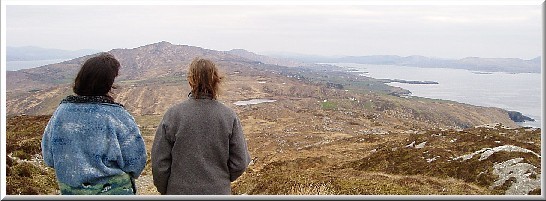
Walk "Out West" on the Sheep's Head Peninsula and be rewarded with new views every few paces.
Far views in every direction over sea, rocky coast and mountains; nearer views of dramatic rocks, valleys, lakes and heathland, in an area which has been described as one of the most unspoilt places in Western Europe, a well-kept secret!
The Ordnance Survey Ireland, Discovery Series Map 88 covers the area, our farm is at map ref: V74778E,35269N; GPS ref 9°48.22.55W´ 51°33.24.09N.
Walking is the best way to explore here as there are few roads - the calls of choughs, ravens and the ever-changing sounds of sea and weather will accompany you.
There are several cross-routes locally, offering several days of superb walking (we can provide picnics and transport), also explore our 36 acres of habitat at your leisure.
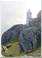
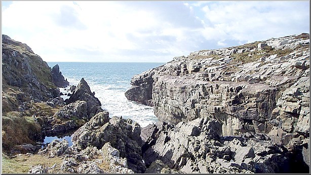
Taking the "Way" West includes the spectacular rugged clifftops of the Northside to the lighthouse, high above deep waters which may reveal whales and dolphins.
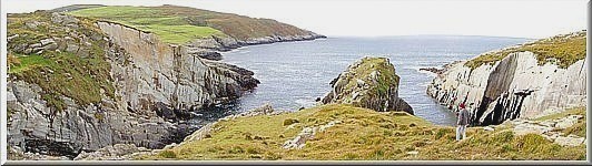
At the end of Sheep's Head, hidden Lough Akeen faces the Atlantic, then the path turns back east, where below you on the Southside are terrace after terrace of tiny ancient fields.
You will find at the end of the road "Out West" Bernies' cafe serving teas, sandwiches, soup etc., with toilets close by.
A cross-route to the North goes through a lonely valley with ruined cottages, part of a circular walk around the end of the peninsula.
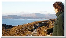
Continuing East on the Southside, the rocky path climbs the summit of Ballyroon Mountain, where from a mere 232m above sea level there are spectacular views.
On a clear day you can see the mountains and loughs of Sheep's Head to the East; to the South, Dunmanus Bay, the Mizen, Roaring Water Bay, Clear Island and the Fastnet Rock; to the West, the Atlantic Ocean and the Cow, Bull and Calf Rocks; and to the North, Bantry Bay, Bear Island, Dursey Island, the Slieve Mishkish and Caha mountains of the Beara, and beyond that to the mountains of the Iveragh Peninsula in County Kerry.
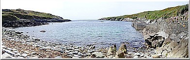
The main Sheep's Head Way path on the Southside, from Laharadda Lough to the small strand at Tra Ruiam and on to Caher, Dooneen and eventually Kilcrohane is gentler and varied, taking in green farmland and small inlets with piers.
For keen hillwalkers, the walk along the Black Gate Path and Peakeen Ridge to Finn MacCool's Seat high above Kilcrohane has wonderful views in all directions.
|
 |
 |
Ballyroon Mountain - Walking